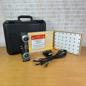
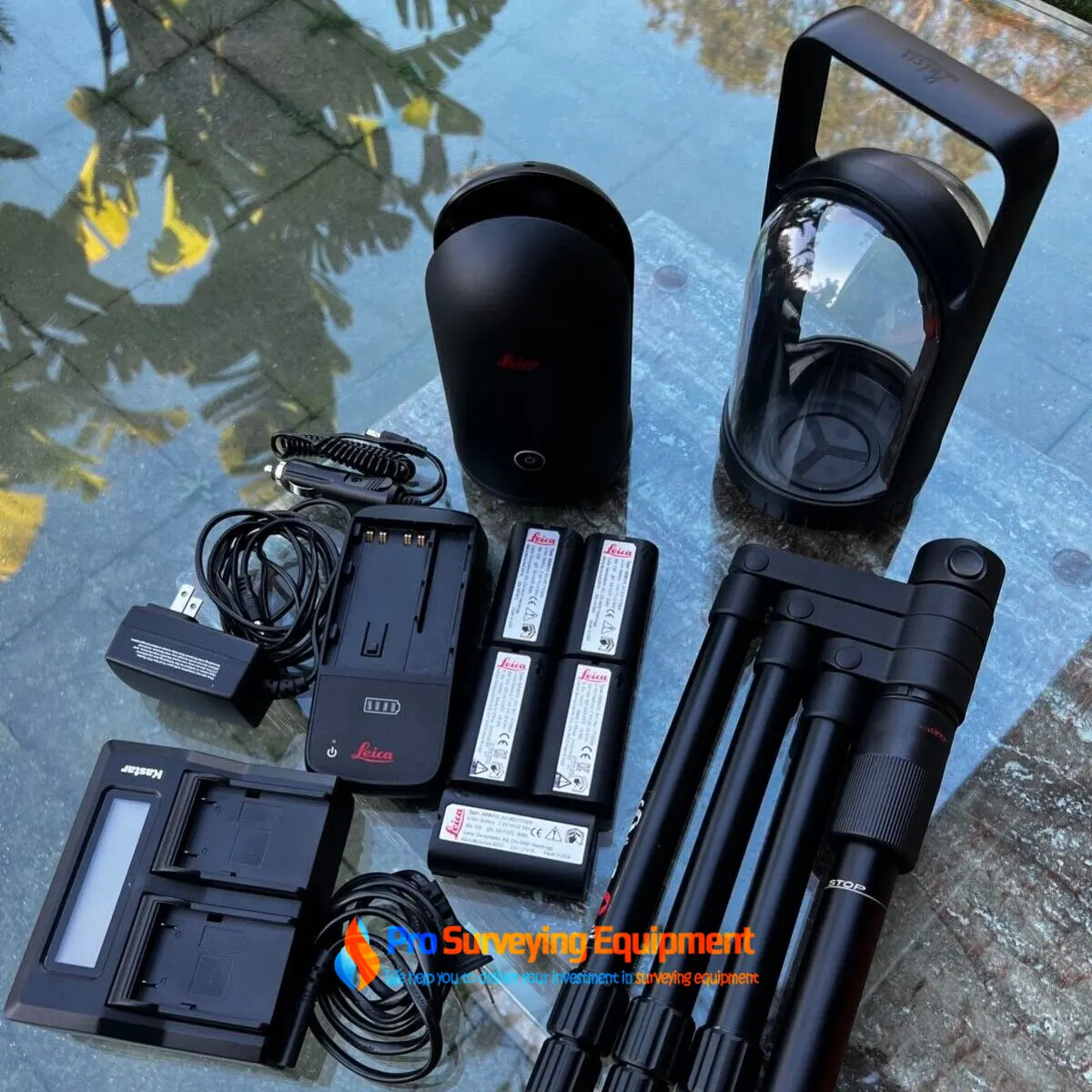
Package includes:
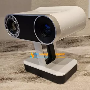
The BLK360 G1 is designed to help new-to-LiDAR users capture point clouds and unlock the potential of using them in many different applications. Ranging from practical uses, such as architecture and surveying, to creative possibilities, such as VR workflows and media location scouting, the BLK360 G1 is meant to make reality capture accessible to everyone.
The BLK360 G1 captures 360,000 points per second, panoramic HDR imagery, and has thermal imaging capability. It is fully compatible with the Leica Geosystems Cyclone Suite of Reality Capture software and powerful enough to be a useful addition to an experienced surveyor’s toolkit.
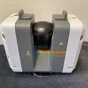
The Leica BLK360 3D Imaging Scanner is a true reality capture breakthrough. It combines a 3D laser scanner, spherical imaging system and thermographic panaorama sensor system. The Leica BLK360 allows you to capture the world around you with the single push of a button. The results are impressive. Full dome 360° x 300° HDR panoramic images overlaid on a highly accurate point cloud. All of this in less than 3 minutes. When creating the Leica BLK360, simplicity and portability were factors. The goal: create the smallest and lightest scanner of its kind. The BLK360 is ideal for architects, renovation/remodel, building construction, crash scene, and shop refurbishment applications. Additionally, 3D visualization gives you the ability to plan and see how future improvements will affect your project area. Easily customize and streamline your workflow by introducing a 3D laser scanner. Finally, partner with software, including Cyclone REGISTER 360, Cyclone JetStream and Cyclone TruView, to save time and cut costs!
Leica BLK360 Laser Scanner features
Working together, the BLK360 and the ReCap Pro mobile app make it easier for AEC professionals to acquire reality capture data for use with the software tools they employ everyday.
Leica BLK360 Specifications:
| GENERAL | |
| Imaging scanner | 3D scanner with integrated spherical imaging system and thermography panorama sensor system |
|
DESIGN & PHYSICAL |
|
| Housing | Black anodized aluminium |
| Dimensions (H x D) | 165 x 100 mm |
| Weight | 1 kg |
| Transport cover | Hood with integrated floorstand |
| Mounting mechanism | Button-press quick release |
|
OPERATION |
|
|
Standalone operation |
One-button operatio |
|
Remote operation |
iPad app, Apple iPad Pro® 12.9”/iOS 10 or later |
| Wireless communication | Integrated wireless LAN (802.11 b/g/n) |
| Internal memory | Storage for > 100 setups |
| Instrument orientation | Upright and upside down |
|
POWER |
|
| Battery type | Internal, rechargeable Li-Ion battery (Leica GEB212) |
| Capacity | Typically >40 setups |
|
SCANNING |
|
| Distance measurement system | High speed time of flight enhanced by Waveform Digitizing (WFD) technology |
| Laser class | 1 (in accordance with IEC 60825-1:2014) |
| Wavelength | 830 nm |
| Field-of-view | 360° (horizontal) / 300° (vertical) |
| Range | min. 0.6 - up to 60 m |
| Point measurement rate | up to 360’000 pts / sec |
| Ranging accuracy | 4mm @ 10m / 7mm @ 20m |
| Measurement modes | 3 user selectable resolution settings |
| IMAGING | |
| Camera system | 15 Mpixel 3-camera system, 150Mpx full dome capture, HDR, LED flash Calibrated spherical image, 360° x 300° |
| Thermal Camera | FLIR technology based longwave infrared camera Thermal panoramic image, 360° x 70° |
| Image modes |
|
| PERFORMANCE | |
| Measurement speed | < 3 min for complete fulldome scan, spherical image & thermal image |
| 3D point accuracy | 6mm @ 10m |
| ENVIRONMENTAL | |
| Robustness | Designed for indoor and outdoor use |
| Operating temperature | +5 to +40° C |
| Dust/Humidity | Solid particle/liquid ingress protection IP54 (IEC 60529) |
|
DATA ACQUISITION |
|
| Live image and scanned data streaming | |
| Live data viewing and editing | |
| Automatic tilt measurements | |